
A mobility hub is a place where you can easily switch between different types of transport – from walking, cycling or an e-scooter to standard buses, or one of the new on-demand WESTlink minibuses, which allow you to connect into the main bus and rail network.
You might see cycle stands and lockers, bike repair stand and pumps, along with mobile phone charging points, and bus stops with digital information screens.
The hubs are designed to bring everything together in one convenient place, to make it as easy as possible to make more sustainable travel choices.
Eight new “mobility hubs” are proposed at key locations along the A37, A362 and A367.
Map of proposed mobility hubs
Proposals
- Make the pavement wider between the High Street and the west end of Church Street
- Create new style pedestrian crossings where the road level is raised to the same height as the pavement - at High Street and both ends of Church Street
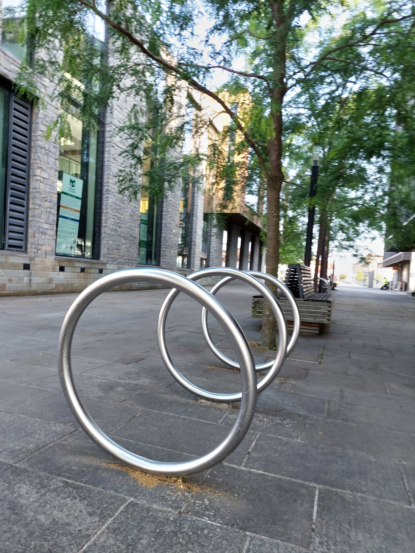
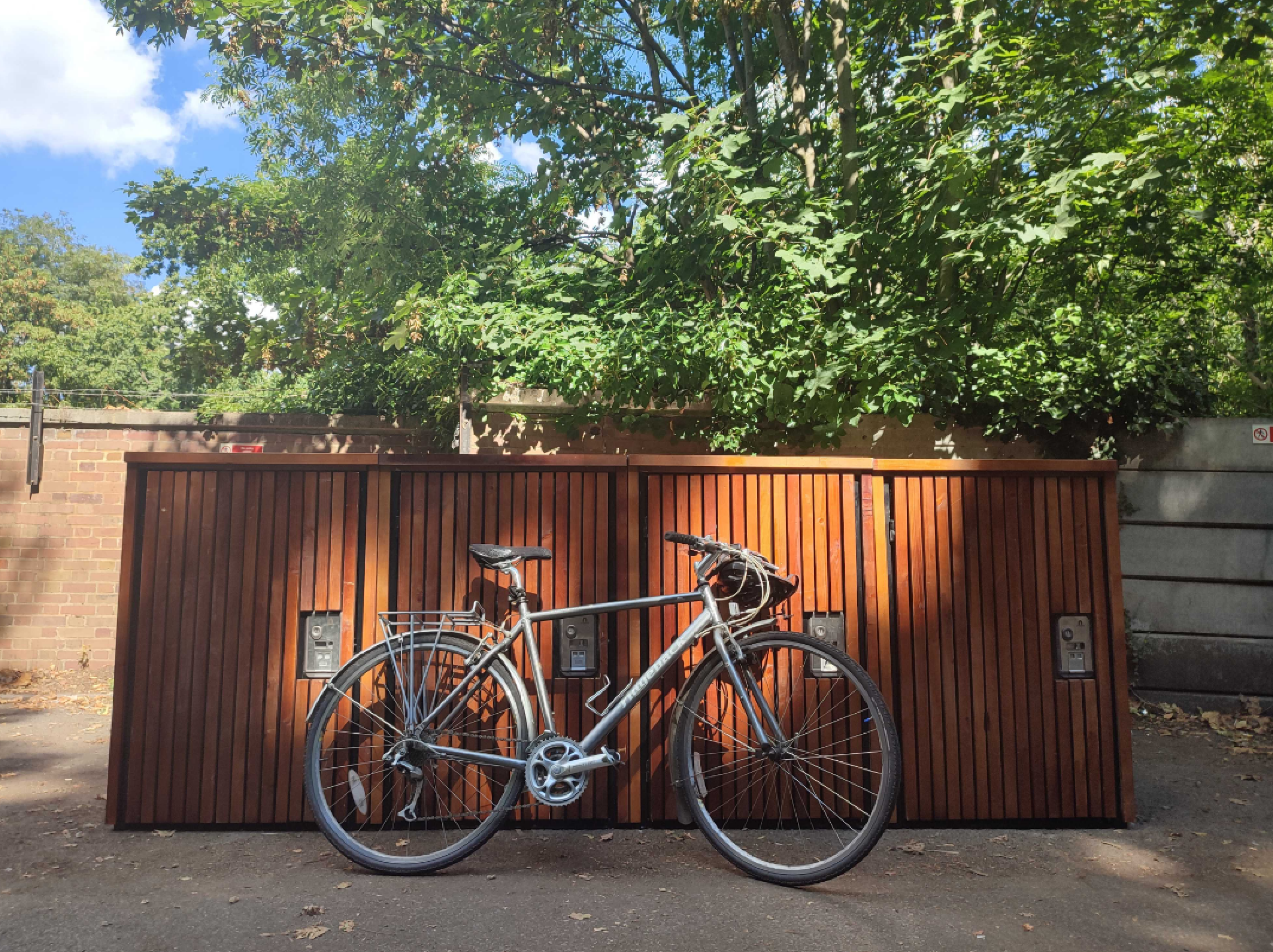
- Help cyclists connect to onward bus services, with new cycle stands for short-term parking and cycle lockers for longer-term parking
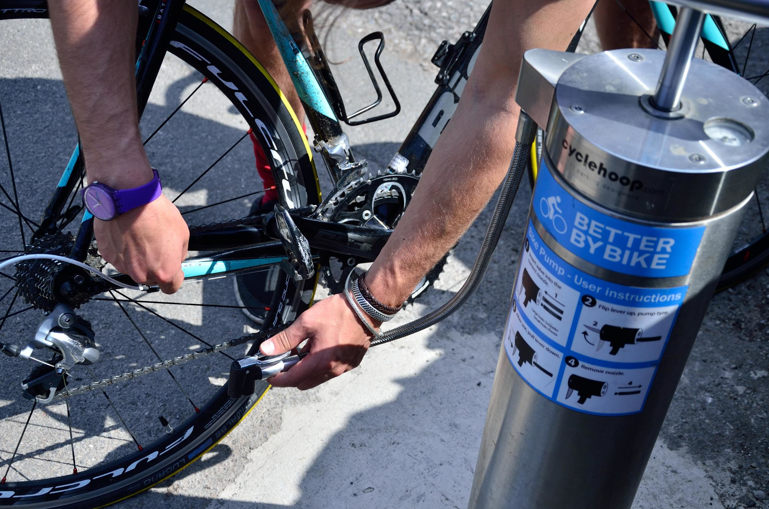
- Install new bike repair stand and pump
What could this mean?
- Vehicles would travel more slowly through the village
- Easier to cross the road safely
- Convenient bike repair facilities
- Easier to visit Pensford by bike and better connections to travel further afield by bus
- Better cycle connections with the proposed A37 quiet route
- Four fewer car parking spaces
Proposals
- Painted spaces for car parking
- Improve the area around the northbound (towards Bristol) bus stop with plants
- Create new style pedestrian crossings at Paulmont Rise where the road level is raised to the same height as the pavement
- Help cyclists connect to onward bus services, with new cycle stands for short-term parking and cycle lockers for longer-term parking
- Install new bike repair stand and pump
What could this mean?
- Vehicles will travel more slowly through the village
- Easier to park and cross the road safely
- Easier to visit Temple Cloud by bike and allow better connections to travel further afield
- Convenient bike repair facilities
- Three fewer car parking spaces
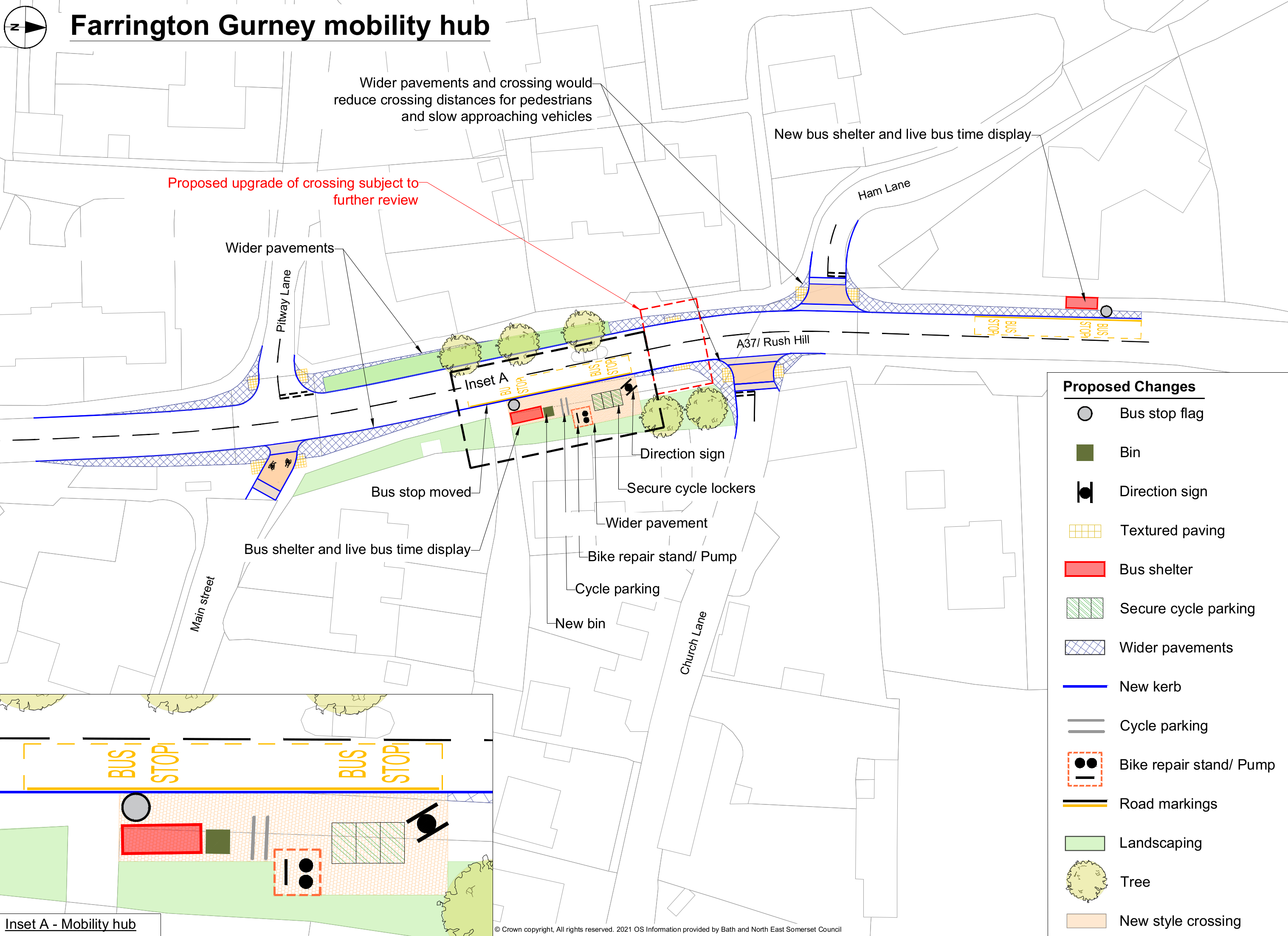
Proposals
- Make the pavement wider to make space for new facilities
- Upgrade the current crossing to one controlled by traffic signals
- Create new style pedestrian crossings where the road level is raised to the same height as the pavement – at Ham Lane and Church Lane
- Help cyclists connect to onward bus services, with new cycle stands for short-term parking and cycle lockers for longer-term parking
- Install a new bike repair stand and pump
What could this mean?
- Vehicles would travel more slowly through the village
- Easier for buses to pull out
- Safer to cross the road
- Convenient bike repair facilities
- Easier to visit Farrington Gurney by bike and allow better connections to travel further afield by bus
- Better cycle connections with Midsomer Norton with the proposed new cycle routes
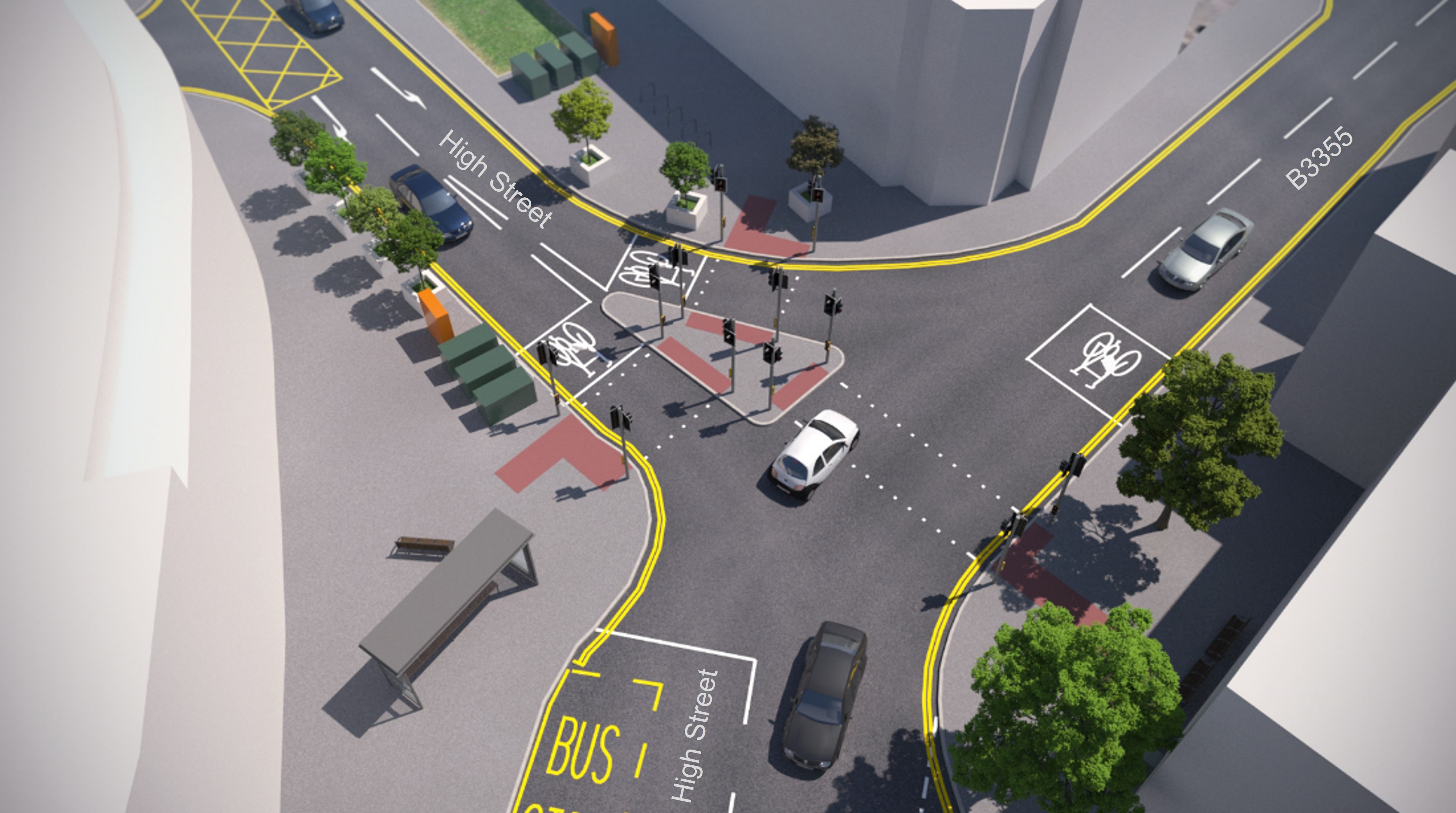
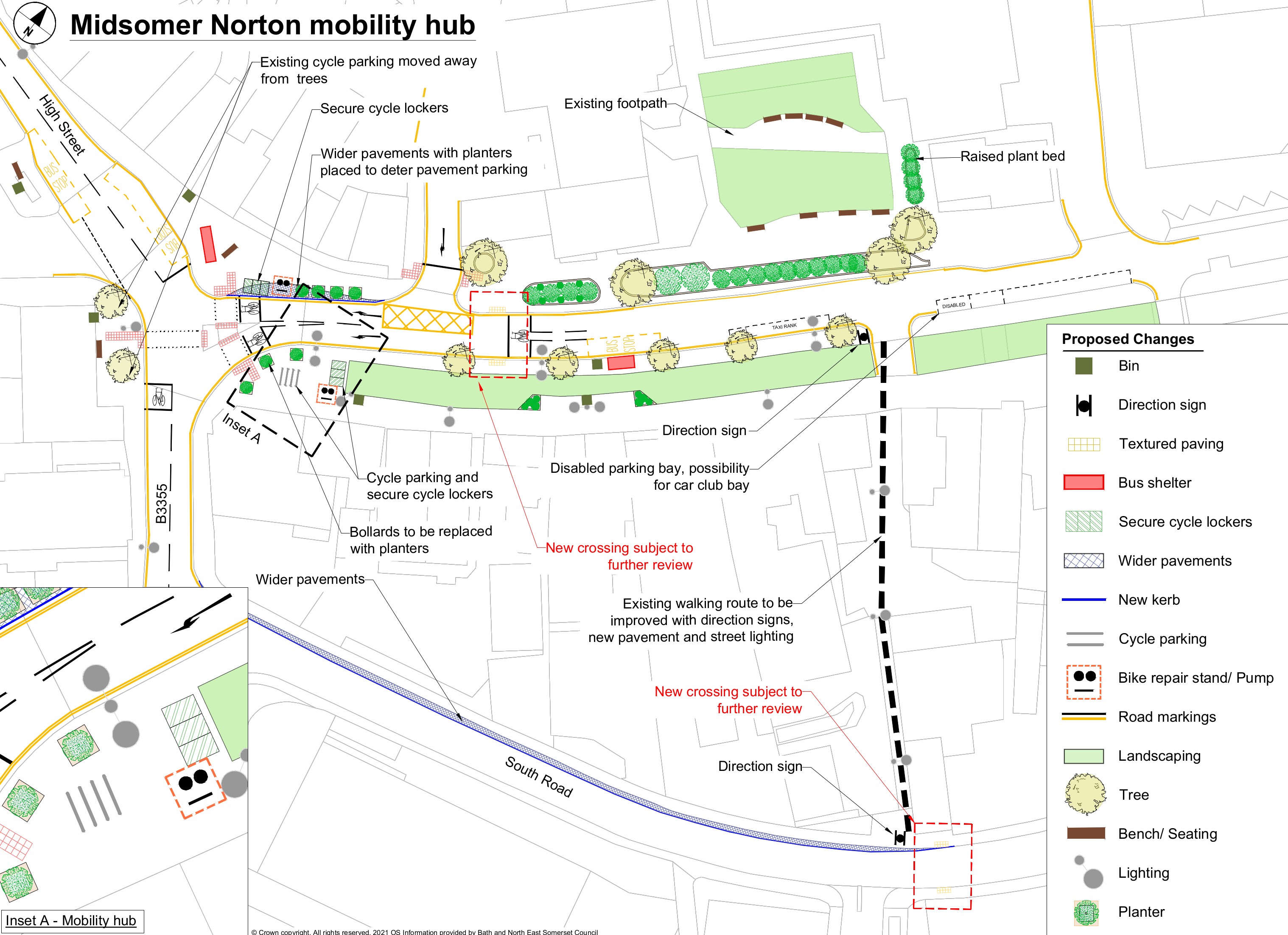
Proposals
- Convert the east side of the High Street / Silver Street junction for pedestrians to use
- Put plants to stop parking on the pavements
- Help cyclists connect to onward bus services, with new cycle stands for short-term parking and cycle lockers for longer-term parking
- Install a new bike repair stand and pump
What could this mean?
- Easier to visit Midsomer Norton by bike and allow better connections to travel further afield
- Convenient bike repair facilities
- Less parking on the pavements
- Five fewer car spaces
Proposals
- Raise sections of nearby roads to the height of the pavements to encourage drivers to reduce their speed
- Help cyclists connect to onward bus services, with new cycle stands for short-term parking and cycle lockers for longer-term parking
- Install new bike repair stand and pumps
What could this mean?
- Vehicles will travel more slowly through the village
- Easier to visit Radstock by bike and allow better connections to travel further afield by bus
- Convenient bike repair facilities
Proposals
- Widen the pavement at Keel’s Hill junction and the north side of Ashgrove
- Move the bus stop currently near St Joseph’s Catholic Church a short distance to the south
- Add potential new crossing on Ashgrove (to the south of Keel’s Hill junction)
- Make new disabled and possible car club parking space
- Help cyclists connect to onward bus services, with new cycle stands for short-term parking and cycle lockers for longer-term parking
- Install a new bike repair stand and pump
What could this mean?
- Vehicles will travel more slowly through the village
- Easier to cross the road
- Easier to visit Peasedown St John by bike and allow better connections to travel further afield by bus
- Convenient bike repair facilities
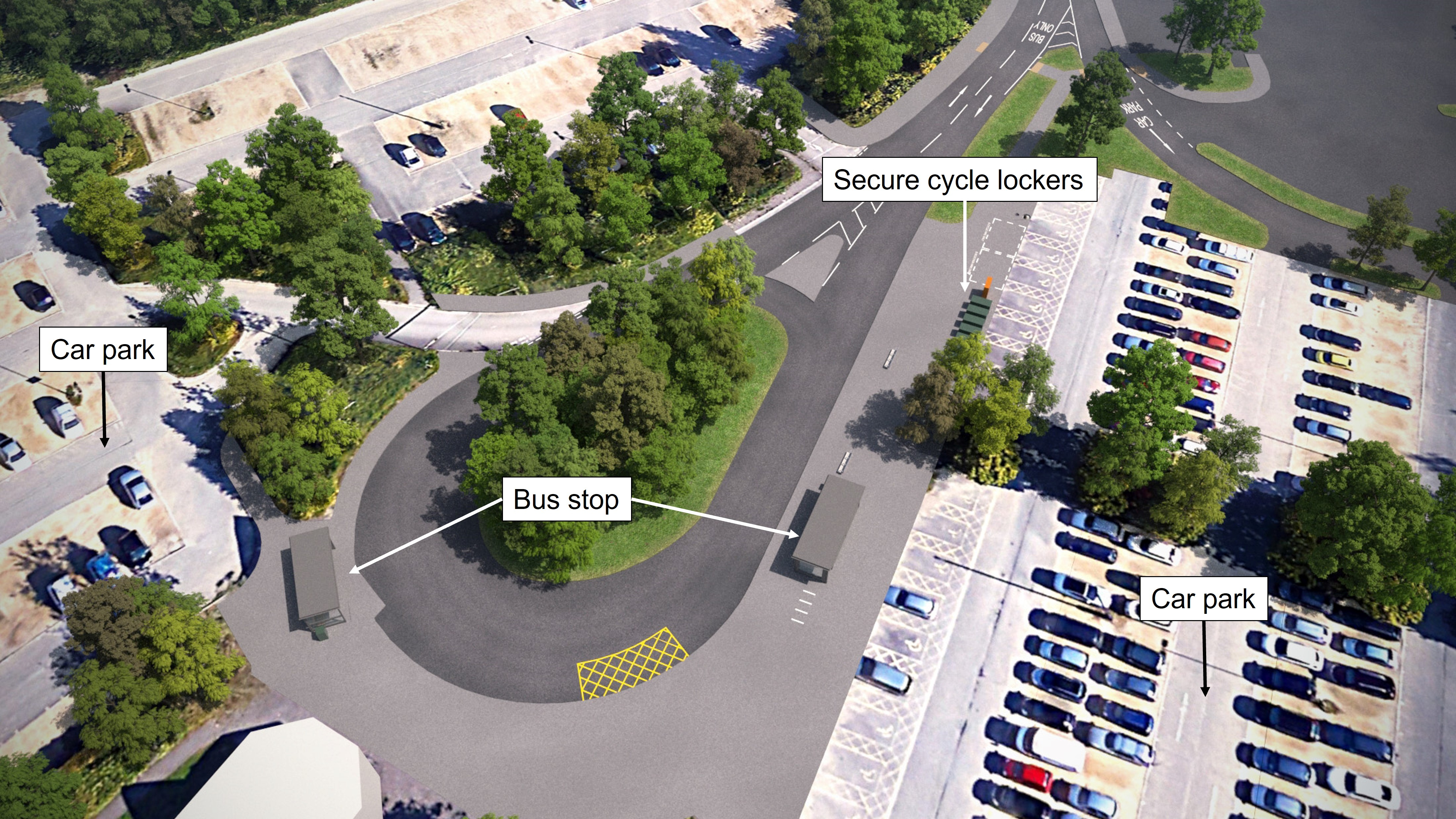
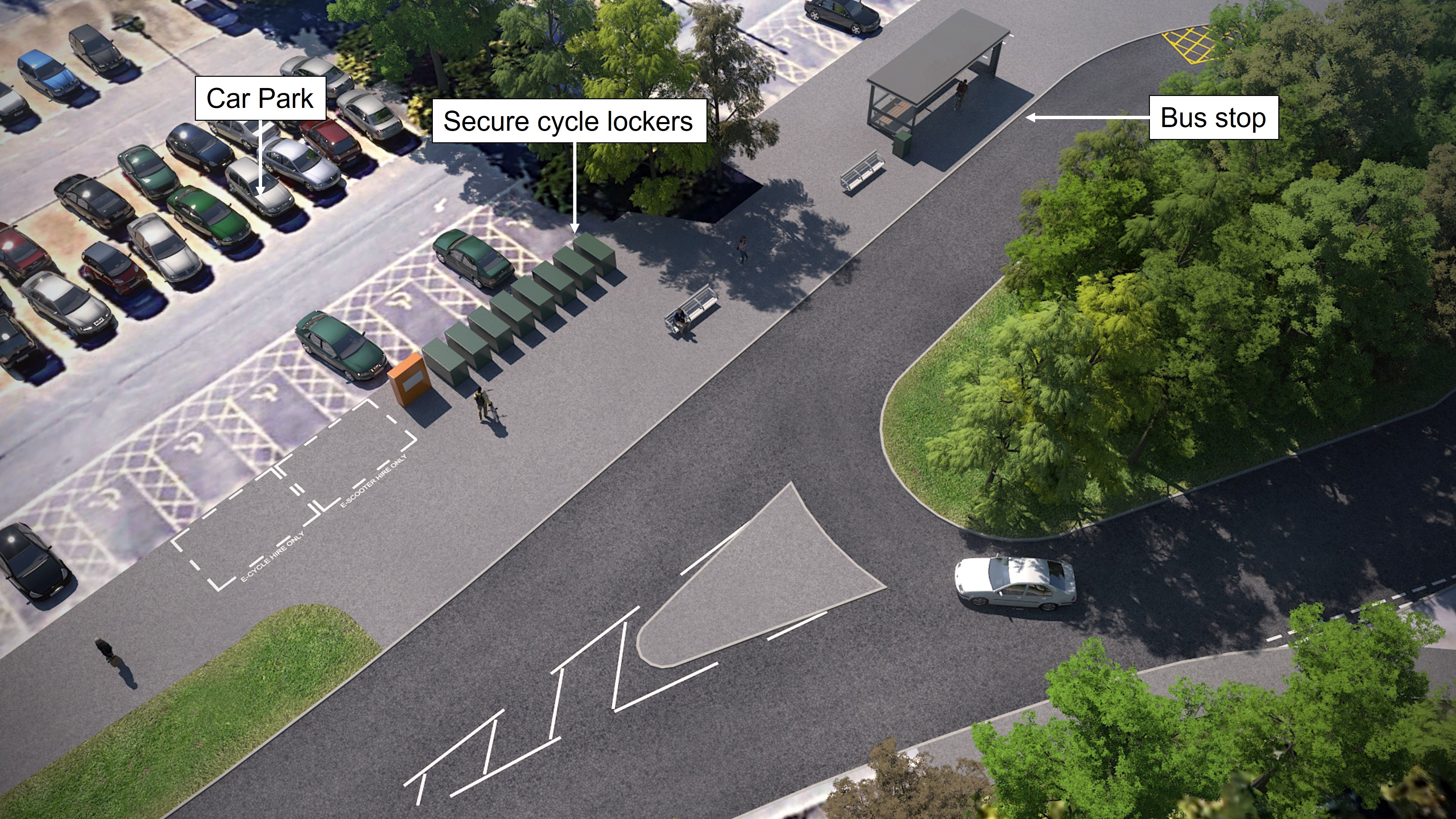
Proposals
- Extend the pavement on the west side of the entrance road of the Park & Ride
- Widen the pavement to make space for new facilities
- Make new spaces for hireable e-scooters and e-cycles
- Provide new marked disabled bays
- Create new short term cycle parking and new cycle lockers for longer term parking helping you to connect to onward bus services
- Install a new bike repair stand and pumps
What could this mean?
- More options to switch between buses and other forms of transport especially cycling
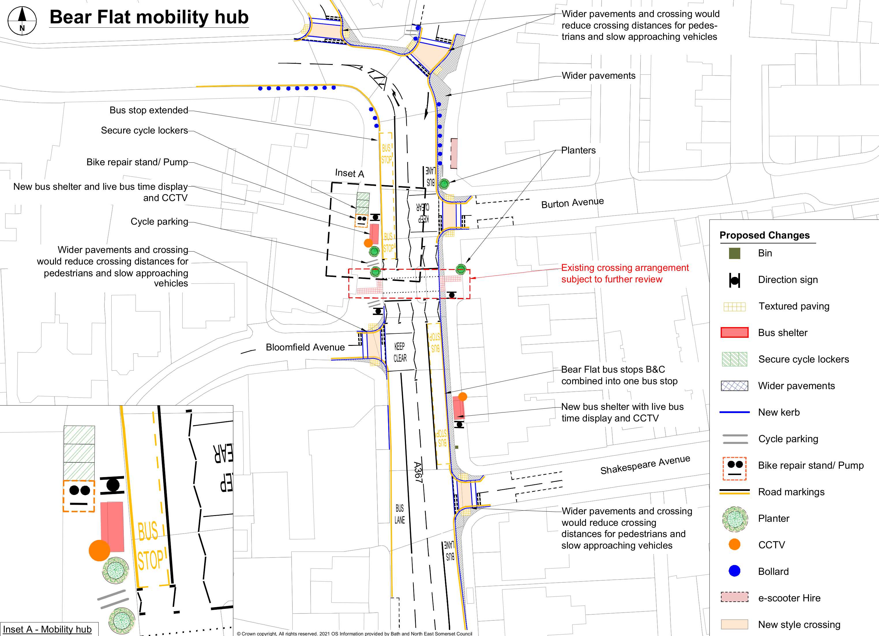
Proposals
- Widen pavements in the area
- Reduce vehicle speeds in sections of most local side roads by raising the level of the road to be the same height as the pavement
- Provide dedicated e-scooter parking
- Help cyclists connect to onward bus services, with new cycle stands for short-term parking and cycle lockers for longer-term parking
- Install new bike repair stand and pumps
What could this mean?
- Safer and easier to cross local roads with narrower junctions
- Easier to visit Bear Flat by bike and allow better connections to travel further afield
- Convenient bike repair facilities
- Fewer issues caused by e-scooter parking
- Two fewer car parking spaces